The Course
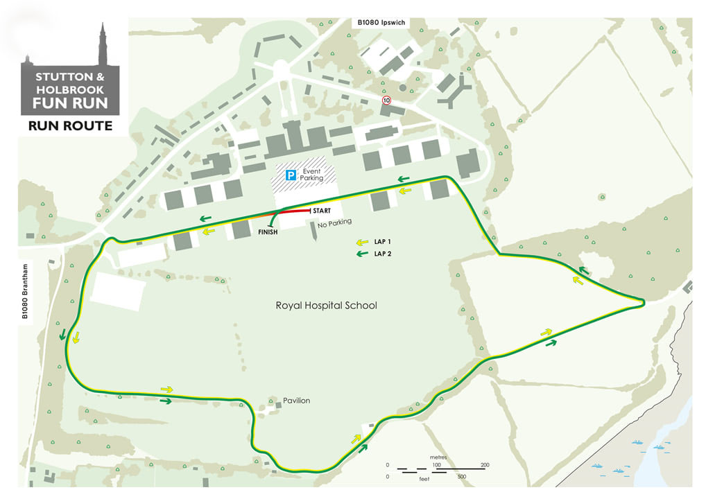
The race is 6ish km in total distance, spread over two laps of approximately 3 km each.
The terrain is predominantly on tarmac. However, the final section on the right-hand side of the map below is an uphill trail, which can become muddy depending on weather conditions in the lead-up to race day.
The section along the top of the map, incorporating the start and finish areas up to the first turn, is flat — apart from the sleeping policemen! After the first turn, the course heads downhill to the bottom of the map, in line with the Pavilion, which is marked on the map. From there, the route remains flat until the uphill trail section mentioned above.
A map of the course is shown below.